Best Alternatives to Agisoft Metashape Professional Full Pc Free Download
Explore top software like Agisoft Metashape Professional Full Pc Free Download in 2026.
Overview
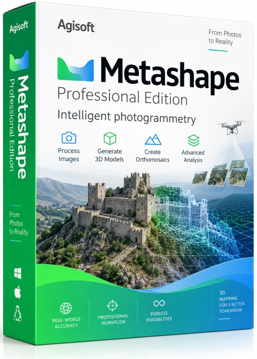
Overview of Agisoft Metashape Professional
Agisoft Metashape Professional is an advanced photogrammetry and 3D reconstruction suite used by surveyors, drone operators, architects, game studios and researchers. It transforms ordinary overlapping photographs into precise 3D models, dense point clouds, textured meshes, digital elevation models and georeferenced orthomosaics. Because the software supports both aerial drone imagery and close-range photos, it has become a standard tool for mapping, heritage documentation, volume calculation and visual effects production.
Many users search for Agisoft Metashape Professional full PC free download packages, but the safest route is the official installer combined with the free 30-day trial or a paid license. The trial offers full functionality with export limits, letting you test the workflow before investing.
Key Features
- Automatic photo alignment and sparse point cloud generation
- Dense cloud, mesh, tiled model and texture creation
- DSM, DTM and orthomosaic export in GeoTIFF and other formats
- Ground control point and marker-based georeferencing
- Support for drone, satellite, fisheye and multi-camera datasets
- GPU acceleration with OpenCL and CUDA support
- Panorama stitching and laser scan integration
- Python API and network processing for large projects
- Batch processing, chunk alignment and project merging
System Requirements
Minimum
- Windows 7, 8, 10 or 11 (64-bit), macOS or Linux
- Intel Core i5 or AMD equivalent processor
- 8 GB RAM
- OpenGL 3.2 compatible graphics card with 2 GB VRAM
- 20 GB free disk space
Recommended
- Intel Core i7 / AMD Ryzen 7 or higher
- 32 GB RAM or more
- NVIDIA GeForce RTX or Quadro GPU with 6 GB+ VRAM
- SSD storage with 100 GB free space
How to Install and Use
Installation
- Step 1: Confirm your PC meets the requirements above.
- Step 2: Download the installer from the official Agisoft website.
- Step 3: Run the setup file and follow the on-screen prompts.
- Step 4: Launch the application and activate the trial or enter your license key.
Basic Workflow
- Step 1: Create a new project and add your photos.
- Step 2: Run Align Photos to build the sparse cloud.
- Step 3: Place markers or ground control points if accuracy matters.
- Step 4: Build the dense cloud, then the mesh and texture.
- Step 5: Generate the DEM and orthomosaic, then export your results.
Pros and Cons
Pros
- Highly accurate, survey-grade reconstruction
- Excellent GPU and multi-core performance
- Rich export formats for GIS and 3D pipelines
- Scriptable via Python for automation
Cons
- Professional license is expensive for hobbyists
- Steep learning curve for beginners
- Demands strong hardware for large datasets
Conclusion
Agisoft Metashape Professional remains one of the most complete photogrammetry solutions available for Windows PCs. It handles everything from simple drone mapping to complex multi-chunk survey projects with impressive speed and precision. If you want to try it, use the official free trial first, then purchase a legitimate license to unlock unlimited exports and priority support. Avoid unofficial mirrors, since modified installers can compromise your system and produce unreliable results.