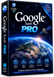
Google Earth Pro Full PC for Windows 10/11
Optimize your PC with the fully compatible Windows 10 version.
Overview
Introduction and Overview
Google Earth Pro Full PC is the professional version of the world's most popular geographic information system (GIS) application, developed by Google. This powerful desktop software allows users to view, analyze, and create detailed geographic data from satellites, aerial photography, and 3D city models. Whether you're a real estate professional looking to showcase properties with GIS data, an urban planner mapping out infrastructure, or a curious traveler exploring the globe, Google Earth Pro offers advanced tools that go far beyond the standard web-based version. Unlike the basic browser edition, the Pro PC version provides high-resolution printing, advanced measurement tools, and the ability to import GIS data, making it an indispensable tool for professionals and enthusiasts alike.
With Google Earth Pro Full PC, you can fly over 3D cities like New York or Tokyo, dive into the depths of the Grand Canyon, or map out a business territory with precision. The software is free to download, yet it retains its enterprise-grade capabilities, making it a hidden gem for anyone needing geospatial intelligence. In this comprehensive guide, we'll explore the key features, system requirements, installation steps, and the pros and cons of this remarkable software, so you can decide if it's the right tool for your needs.
Key Features
- Advanced Measurement Tools: Measure distances, areas, and even 3D heights with the ruler tool — ideal for architects, engineers, and surveyors.
- GIS Data Import: Import ESRI shapefiles, KML/KMZ files, and CSV spreadsheets to overlay your own data onto the Earth's imagery.
- High-Resolution Printing: Print images up to 4800 pixels wide, perfect for presentations, reports, and marketing materials.
- Historical Imagery: Slide back in time to see how landscapes, cities, and coastlines have changed over decades using the historical timeline.
- 3D Terrain and Buildings: Explore realistic 3D models of major cities, terrains, and even underwater volcanic features.
- Movie Maker: Record media-based tours as MP4 or Windows Media videos to share your virtual travels with others.
- GPS Tracking: Connect your GPS device to import tracks and waypoints, useful for hiking and field research.
- Sunlight and Shadow Simulation: Analyze solar exposure and shadow patterns across any location, beneficial for solar panel placement or architecture.
- Street View Integration: Seamlessly switch to street-level imagery in over 100 countries.
System Requirements
To run Google Earth Pro Full PC smoothly, your computer should meet the following minimum and recommended specifications. Having a more powerful system ensures faster rendering and a better overall experience.
Minimum Requirements
- Operating System: Windows 10, 8, or 7 (64-bit) / macOS 10.12+ / Linux with 64-bit support
- CPU: 1 GHz or faster processor
- RAM: 2 GB of system memory
- Hard Disk: 2 GB of free disk space
- Graphics Card: DirectX 9 or later with 3D acceleration support
- Display: 1024x768 screen resolution, 16-bit color quality
- Internet: Broadband connection for online streaming and updates
Recommended Requirements
- Operating System: Windows 11 or 10 (64-bit) / macOS 13+ / Linux (latest 64-bit distro)
- CPU: Dual-core or higher for faster loading
- RAM: 4 GB or more
- Hard Disk: 4 GB of free space (SSD highly recommended)
- Graphics Card: Dedicated GPU with 1 GB VRAM (e.g., NVIDIA GTX 1000 series or better)
- Display: 1920x1080 resolution, true color (32-bit)
- Internet: High-speed broadband (25 Mbps or higher) for seamless streaming of imagery
How to Install and Use
Installing Google Earth Pro Full PC is a straightforward process. Follow these step-by-step instructions to get started.
Installation Steps
- Download: Visit the official Google Earth page or a trusted software download site and click the download button for Google Earth Pro. Make sure to select the version compatible with your operating system (Windows, macOS, or Linux).
- Run the Installer: Once the download is complete, open the installer file (e.g., GoogleEarthProSetup.exe on Windows). If prompted by User Account Control, click 'Yes' to allow the installer to run.
- Follow the Prompts: The setup wizard will appear. Click 'Next' to proceed, review the license agreement, and accept the terms. You can choose the installation location or leave the default settings.
- Complete Installation: Click 'Install' and wait for the installation to finish. Once done, click 'Finish' to launch Google Earth Pro.
How to Use
- Launch the App: Open Google Earth Pro from your desktop shortcut or start menu. The 3D globe will load, and you can navigate by dragging your mouse or using the keyboard controls.
- Search for a Location: Use the search bar in the top-left corner to enter any address, city, or GPS coordinate. Press Enter to fly there.
- Add Data: To import GIS data, click 'File' > 'Import' and select your shapefile, KML, or CSV file. The data will appear as layers on the map.
- Use Measurement Tools: Click the ruler icon to measure distances, areas, or 3D heights. Select the unit of measurement and click on the map to trace the path.
- Explore Historical Imagery: Click the history icon (clock with an arrow) and drag the slider to view past satellite images.
- Print or Save Images: Use the 'File' > 'Print' option to generate high-resolution prints, or click the 'Save Image' button to export as JPG or PNG.
Pros and Cons
Like any software, Google Earth Pro Full PC has its strengths and limitations. Here's a balanced look to help you make an informed decision.
Pros
- Free and Powerful: Despite being a professional tool, Google offers it completely free of charge with no hidden fees.
- Comprehensive Geospatial Tools: From GIS data import to advanced measurement, it rivals expensive GIS software.
- High-Quality Imagery: Access high-resolution satellite imagery that is regularly updated.
- Offline Functionality: You can cache imagery for offline use in remote locations, which is a huge advantage for fieldwork.
- Cross-Platform: Available on Windows, macOS, and Linux, so it fits into any environment.
- Excellent Historical Data: The ability to compare past and present imagery is unmatched and useful for research.
Cons
- Steep Learning Curve: New users may find the array of features overwhelming without proper tutorials.
- Resource-Heavy: Can be demanding on older or entry-level hardware, especially when streaming 3D imagery.
- Occasional Data Glitches: Some users report outdated or missing imagery in certain regions, though rare.
- Limited Real-Time Data: Unlike web-based versions, some live data feeds (like weather) are not updated as frequently.
- Privacy Concerns: The detailed imagery can raise privacy issues, and users must be mindful of how they use the data.
Conclusion
Google Earth Pro Full PC remains the gold standard for free geospatial software, blending powerful professional tools with an intuitive 3D interface. Whether you're mapping real estate, planning scientific expeditions, or simply satisfying your wanderlust, this desktop application offers capabilities that far surpass its browser-based sibling. Its free price tag, combined with extensive features, makes it a must-have for educators, researchers, and professionals across industries. While it may have a few minor drawbacks, such as its learning curve and resource demands, the benefits overwhelmingly outweigh the negatives.
If you haven't yet tried Google Earth Pro, now is the perfect time to download it. With the step-by-step guide provided above, you'll be soaring across the globe in minutes, uncovering data-rich landscapes and capturing breathtaking views with ease. Embrace the world from your desktop — download Google Earth Pro Full PC today and transform the way you see the planet.